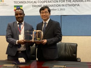
 At the SmartGeo Expo in Seoul today, the Korean Institute of Aviation Safety Technology (KIAST) signed a ground-breaking MOU with the Ethiopian Ministry of Urban and Infrastructure Development (MUID) to advance drone mapping in Ethiopia. The project will be led on the ground by Korean drone-based geomatic and survey experts Hojung Solutions.
Continue reading below, or listen:
The agreement will bring drone-based mapping services and significant skills transfer efforts to Ethiopia – and has the power to be an effective tool of change. “This MOU will begin a collaborative effort to create the elements necessary to establish sharing of drone skills, safety framework, and sustained growth in drone applications,” said Hojung Vice President Andrew Cho.
Hojung Solutions will bring their expertise in drone mapping to the country: with the support of KIAST, they will establish a framework for skills transfer that will develop a local workforce for commercial drone applications, with the goal of creating a “Center of Excellence” program to maintain aviation safety standards along with piloting and application skills.
 It’s a unique model, and one of the ways that Korean government institutions have taken active steps to support the drone industry. KIAST is responsible for aircraft certification and safety standards: the Advanced Aviation Research Division’s charter includes both the development of UAS regulations and safety standards, and the support and development of the Korean drone industry. By partnering with Hojung for the project, they are able to provide both safety and standards expertise as well as drone-based mapping services for Ethiopia.
Hojung Solutions CEO, Munsoek Lee explained that geospatial information is a powerful tool for change in Ethiopia. “With good geospatial information, Ethiopia will be able to solve many problems, including fair land taxation,” he says. “When you know where the people are, you can start to develop the road and water infrastructure more effectively.”

According to the U.S. International Trade Administration, Ethiopia’s 10-year (2020 to 2030) transport sector perspective plan is massively ambitious. As of the end of FY 2019/20, Ethiopia had 144,024 kilometers (89,492 miles) of all-weather roads: the Ethiopian government plans to build an additional 10,000 kilometers of road including expanding the highway network to 1,600 km over the next ten years. Road development plays a key part in the country’s plans for economic development – and drone mapping offers an effective way to bring both geospatial information and technology transfer to the region.
Hojung Solutions will use UCONSYSTEM aircraft, including the hand-launched Remo-M model and new eVTOL fixed wing endurance drone.
Read more about Hojung Solutions and the Korean drone industry:
- Urban Air Mobility in Korea: Volocopter Conducts First Crewed Public Air Taxi Flight
- Korean Drones at CommUAV Expo: Why Koreas Drone Industry is Racing Ahead
- Drone Inspections for Wind Turbines in as Little as 15 Minutes: Korean Drone Software Company Nearthlab
- Ehang Passenger Drone Makes Debut Flight in Korea: Air Taxis a Dream of Mankind [VIDEO]
- South Korea Taking a Major Place in the Global Drone Industry

Miriam McNabb is the Editor-in-Chief of DRONELIFE and CEO of JobForDrones, a professional drone services marketplace, and a fascinated observer of the emerging drone industry and the regulatory environment for drones. Miriam has penned over 3,000 articles focused on the commercial drone space and is an international speaker and recognized figure in the industry. Miriam has a degree from the University of Chicago and over 20 years of experience in high tech sales and marketing for new technologies.
For drone industry consulting or writing, Email Miriam.
TWITTER:@spaldingbarker
Subscribe to DroneLife here.


[…] post South Korean Drone Industry is Solving Global Problems: from the Floor of SmartGeo Expo appeared first on […]