by DRONELIFE Staff Writer Ian M. Crosby
Advanced drone operator IN-FLIGHT Data, alongside advanced radar and remote sensing technologies leader DeTect Inc., completed a demonstration showcasing the importance of advanced radar when operating drones beyond visual line of sight (BVLOS) and within populated areas.
Continue reading below, or listen:
This accomplishment has made IN-FLIGHT Data the first ever drone operator in North America to carry out an urban cellular and radio network mapping project of this scale.
An advanced radar and remote sensing technologies specialist, DeTect develops solutions for the protection of airspace surrounding various critical sites from airborne hazards. Radar provides a means of granting drone operators airspace awareness surrounding other airspace users, with DeTect’s technology seeing deployment in a range of use cases including BVLOS flights.
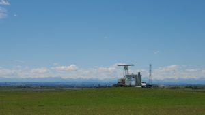
As a result of concerns surrounding drone operation in areas close to sensitive bird populations, radar was utilized to grant additional safety, awareness and surveillance of all airspace users within the project’s vicinity, including birds. This same radar is currently employed elsewhere in Canada.
“Flying in urban environments, when the aircraft is beyond the line of sight of the pilot, is stressful and requires the pilot and crew’s full attention and awareness,” said IN-FLIGHT Data President Chris Healy. “The air band was busy with ATC communications. The airspace was busy with air space users of many types. It cannot be overstated how valuable the fused Unmanned Traffic Management (UTM) system and radar tools, including hardware and software, used by the project were – not only to the safety of the mission, but also for helping ease the stress burden on our air crew of a busy metro air space.”
The integrated solution offered roughly 15 NM / 28 km of airspace surveillance and remote reporting surrounding the project and throughout the City of Calgary. The mission area’s viewshed at all heights (>150 feet AGL) was ideal in every direction, with the entire airspace under surveillance within 3 NM of the missions. Surveillance coverage remained at over 90% in all directions at out to 5 NM. Flight missions conducted In July and August covered an operational area of about 22,000 acres within the City.
Canada GM James MacFarlane emphasized the importance of demonstrating the technology’s ability to cover a city of this size: “Projects such as the Calgary Project demonstrate that in order for cities to enable and scale the future of urban air mobility (UAM), they must first enable and promote networks, like airspace awareness, that qualified air operators can benefit from, while keeping operational costs low.”
A thorough understanding of the network performance is necessary in supporting further developments in aviation, as well as in evaluating how UAM, drones and infrastructure can leverage those networks for the benefit of cities and their citizens.
Read more about IN-FLIGHT and DeTect:
- Its a Bird – Its a Drone -DeTect Dual Function Radar Tracks Both
- In Calgary, a SAIL 4 BVLOS Urban Drone Operation Measures Aerial Network Performance
Ian attended Dominican University of California, where he received a BA in English in 2019. With a lifelong passion for writing and storytelling and a keen interest in technology, he is now contributing to DroneLife as a staff writer.
Miriam McNabb is the Editor-in-Chief of DRONELIFE and CEO of JobForDrones, a professional drone services marketplace, and a fascinated observer of the emerging drone industry and the regulatory environment for drones. Miriam has penned over 3,000 articles focused on the commercial drone space and is an international speaker and recognized figure in the industry. Miriam has a degree from the University of Chicago and over 20 years of experience in high tech sales and marketing for new technologies.
For drone industry consulting or writing, Email Miriam.
TWITTER:@spaldingbarker
Subscribe to DroneLife here.