Mapping with Thermal Drones: Teledyne FLIR Talks Best Practices
Teledyne FLIR are the world leaders in thermal imaging. Mapping with thermal drones equipped with longwave infrared (LWIR) cameras – whether for solar farm or roof inspections, or for search and rescue or security missions, is getting more critical as drone flight beyond visual line of sight (BVLOS) gets closer for commercial drone applications. New opportunities for applications like long linear pipeline inspections and long range search and rescue are expanding – and technology is evolving to meet growing demand.
In a webinar designed to help new users adopt proven best practices, the experts at Teledyne FLIR discuss the importance of resolution and altitude, emissivity and temperature accuracy, and when to use qualitative vs. quantitative data.
Mapping with Thermal Drones: Resolution and Altitude

Emissivity: The Key to Temperature Accuracy
Emissivity, say the experts at Teledyne FLIR, is by far the most important factor in getting accurate temperature data. Emissivity refers to the ratio of energy emitted by an object compared to energy emitted by a blackbody: the surface’s ability to emit rather than reflect infrared energy. Solar panels, for example, may have a uniform emissivity: but roofing materials vary widely.
Understanding emissivity of your target is crucial if you are looking for quantitative data.
Qualitative vs. Quantitative Data: The Right Tool for the Job
Qualitative, or non-radiometric data measures the relative difference of a target from its surroundings. Quantitative, or radiometric data, measures the temperature of a target. Applications like search and rescue, fighting wildfires, roof inspections, or agriculture only require qualitative data to find a person, a hotspot in a wildfire, or a potential leak in a roof. Commercial applications like solar or utility inspections, however, require quantitative data to know if a you have a real problem.
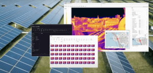
Radiometric cameras for applications that require quantitative data store temperature data for each pixel within an image. Since thermal infrared energy from a surface can change based on angle of observation and time of day, it’s especially important to complete missions quickly and to pay attention to parameters like image overlap.
Some General Best Practices
1) Avoid Motion Blur. Fly low enough to serve the purpose, but slow enough to get good imagery – generally no faster than 12 – 15 mph.
2) Overlap and Sidelap. For orthomosaics, the overlap and sidelap parameters are 80% by 80% for most processing engines.
3) Time of Day. Choose the time of day when any temperature difference or anomoly will be most pronounced. Consider potential impacts of weather and solar loading from the sun. For solar panel inspections, that’s before noon: but for roofing inspections, that’s at dawn or dusk when there are shadows.
Mapping with thermal drones is a complex application, but one that offers significant return on investment. Sensors and processing software is continually evolving and improving to make the process easier and more accurate. For more information on thermal orthomosaics and more, check out Teledyne FLIR’s extensive library of educational resources.
Miriam McNabb is the Editor-in-Chief of DRONELIFE and CEO of JobForDrones, a professional drone services marketplace, and a fascinated observer of the emerging drone industry and the regulatory environment for drones. Miriam has penned over 3,000 articles focused on the commercial drone space and is an international speaker and recognized figure in the industry. Miriam has a degree from the University of Chicago and over 20 years of experience in high tech sales and marketing for new technologies.
For drone industry consulting or writing, Email Miriam.
TWITTER:@spaldingbarker
Subscribe to DroneLife here.