• Skip to main content
  • Skip to secondary menu
  • Skip to primary sidebar
  • Skip to secondary sidebar
  • Skip to footer
  • DroneRacingLife
  • DroneFlyers
  • Newsletter
DroneLife

DRONELIFE

Stay up to date on all the latest Drone News

  • News
  • Products
  • Industries
    • Agriculture
    • Construction
    • Delivery
    • Dual Use
    • Inspection
    • Public Safety
    • Surveying
  • Enthusiasts
  • Regulations
  • Business
  • Video
  • Podcasts

Residential Solar Surveys with Drones: Why You Should Always Include Oblique Imagery

October 25, 2021 by Miriam McNabb 6 Comments

residential solar surveys
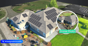
Residential solar surveys are a great opportunity for commercial drone service providers.  Here, an expert gives advice on getting the very best output.

The following is a guest post by Jason Steinberg, CEO of Scanifly: the only drone-based solar software committed to improving the efficiency, accuracy and safety of solar projects globally.  DRONELIFE neither accepts nor makes payment for guest posts.

Most drone pilots are familiar with grid or lawn mower-shaped flight paths shot with nadir imagery. These patterns are easy to program – just set the perimeter, click the button, and go. But a residential rooftop solar project has more nuanced considerations, including the accuracy of the property and surrounding environment.

The additional nuances of residential rooftop solar lead to three key reasons why capturing oblique imagery is a more effective approach.

Nadir versus oblique

A nadir image is captured when the drone flies with the camera facing straight down or at a slight angle. These “nadir” images typically yield lower quality models because z-axis structures are less visible.

An oblique image is captured when the drone captures images at a side angle, displaying vertical and horizontal features of a property. Further, when done to maximize model quality, a drone will capture oblique images from different altitudes and perspectives.

1. More easily spot trees and other vegetation

Nadir images might spot trees or other vegetation on the property (as in, you’ll know they are there). But it is more difficult to model how big they are or how much they obstruct the roof. Oblique imagery, on the other hand, can easily spot how vegetation may impact a solar installation because you get a realistic impression of what the vegetation actually looks like in context and as it affects a sun’s path.

This matters a lot because poor vegetation recognition can incorrectly depict a solar shading analysis, which is critical for accurately modeling a solar project’s expected production. An incorrect forecast could leave the homeowner expecting a lot more than they ultimately receive. In that case, homeowners and contractors alike would be very unhappy.

2. Better detect small obstructions

Pointing a camera straight down negatively impacts detecting small obstructions, like vent pipes and attic fans, because the verticality of those objects aren’t effectively modelled. Missing obstructions in your modelling can derail a solar project by forcing a redesign, delaying an install, or negatively impacting customer expectations.

Oblique imagery will better present the X, Y, and Z-axes of a property, meaning you’ll more easily spot obstructions and can plan around them. This might mean a smaller installation, yet you can adjust customer expectations ahead of time to avoid problems on install day.

3. Increase sales using oblique images

Models created from nadir images lack real-world features. Often facades can look melted and the sides of structures blurred. Or worse, a nadir image misses data and yields holes in a model reconstruction. Oblique imagery, on the other hand, can yield truly comprehensive, interactive 3D models. Not only does this help solar designers get more context about the site, the images can be used for marketing and showing customers what the finished project will look like. These to-scale, virtual replica models are sometimes so good that they look like photos of real homes.

Don’t lose on bad data

Installing a solar project is like putting a mini-power plant on your roof. It’s best practice to capture the most thorough details possible. Thankfully, multiple drones (like DJI’s Mavic Pro or Phantom Series, Autel’s flagship drone, and Skydio) now make it much easier to automatically capture oblique imagery. This enables accuracy to within 2-3 inches and clarity to streamline and automate much of a solar project’s workflow.

Read more from Jason at Scanifly in this piece on flying a drone in challenging conditions, and combining the best technologies for the best in 3D modeling.

Jason Steinberg

Jason Steinberg is the CEO of Scanifly and oversees the operational and financial aspects of the company. Scanifly is the only drone-based solar software committed to improving the efficiency, accuracy and safety of solar projects globally. Previously, Jason helped finance over $3 billion of renewable energy projects and companies as a banker for CohnReznick Capital. Prior to that, Jason worked for Bloomberg New Energy Finance as a lead North American data researcher. Jason’s first job in the industry was installing solar arrays on rooftops in New Jersey. Jason is a FAA Part 107, CFA Charterholder and a NABCEP PV Associate.


Miriam McNabb

Miriam McNabb is the Editor-in-Chief of DRONELIFE and CEO of JobForDrones, a professional drone services marketplace, and a fascinated observer of the emerging drone industry and the regulatory environment for drones. Miriam has penned over 3,000 articles focused on the commercial drone space and is an international speaker and recognized figure in the industry.  Miriam has a degree from the University of Chicago and over 20 years of experience in high tech sales and marketing for new technologies.
For drone industry consulting or writing, Email Miriam.

TWITTER:@spaldingbarker

Subscribe to DroneLife here.

Filed Under: Drone News Feeds, News Tagged With: 3D models, drone inspections, drone roof surveys, residential solar surveys, Scanifly

Reader Interactions

Trackbacks

  1. How To Get High-Quality Outsourced Solar Designs - Scanifly says:
    March 3, 2025 at 4:33 pm

    […] can easily create a to-scale virtual replica 3D model that visually shows the roof’s contours, obliques, and obstructions using Scanifly software. Working from satellite or other remote imagery, on the […]

    Reply
  2. Residential Solar Surveys with Drones: Why You Should Always Include Oblique Imagery - DronesOnline.site says:
    November 1, 2021 at 6:05 pm

    […] post Residential Solar Surveys with Drones: Why You Should Always Include Oblique Imagery appeared first on […]

    Reply
  3. Residential Solar Surveys with Drones Oblique Imagery – Dronestagram Blog says:
    October 29, 2021 at 7:55 pm

    […] More… […]

    Reply
  4. Residential Solar Surveys with Drones Oblique Imagery – DRONELIFE – DroneLife says:
    October 27, 2021 at 11:38 pm

    […] source […]

    Reply
  5. Residential Solar Surveys with Drones Oblique Imagery - DRONELIFE - DroneLife - K드론팀 says:
    October 25, 2021 at 4:57 pm

    […] Residential Solar Surveys with Drones Oblique Imagery – DRONELIFE  DroneLife […]

    Reply
  6. Residential Solar Surveys with Drones: Why You Should Always Include Oblique Imagery - Drone Films Limited says:
    October 25, 2021 at 2:20 pm

    […] post Residential Solar Surveys with Drones: Why You Should Always Include Oblique Imagery appeared first on […]

    Reply

Leave a Reply Cancel reply

Your email address will not be published. Required fields are marked *

Primary Sidebar

LATEST

XTEND and ParaZero Partner to Deliver Autonomous Drone Interception System

New integration combines AI-powered drone platform with net-based capture system for counter-UAS missions JFB Construction Holdings and XTEND have announced…

Continue Reading XTEND and ParaZero Partner to Deliver Autonomous Drone Interception System

EU Fast-Tracks €115M Defense Innovation Fund to Accelerate Drone and AI Deployment

EU to earmark €115 million for AI, drone innovation By DRONELIFE Features Editor Jim Magill The governing body of the…

Continue Reading EU Fast-Tracks €115M Defense Innovation Fund to Accelerate Drone and AI Deployment

DeTect Reorganizes into Three Global Regions to Support Growth

New leadership structure aims to strengthen global operations and customer support DeTect, Inc. has announced a new organizational structure designed…

Continue Reading DeTect Reorganizes into Three Global Regions to Support Growth

Barksdale Drone Incursions Highlight Real Security Risks

Confirmed incursions at a strategic U.S. bomber base highlight real risk A Week of Drone Incursions at a Strategic Base…

Continue Reading Barksdale Drone Incursions Highlight Real Security Risks

Blue Innovation Deploys Drones for Nighttime Wildfire Imaging in Japan

This article published in collaboration with JUIDA, the Japan UAS Industrial Development Association.     Blue Innovation Co., Ltd. deployed drones…

Continue Reading Blue Innovation Deploys Drones for Nighttime Wildfire Imaging in Japan

University of Kentucky Researcher Wins NSF Award for Drone Fleet Safety Research

A University of Kentucky researcher has received a National Science Foundation (NSF) CAREER Award worth $534,264 over five years to develop safer…

Continue Reading University of Kentucky Researcher Wins NSF Award for Drone Fleet Safety Research

Canada Bets Big on Sovereign Drone Power with New National Innovation Hub

Canada to establish Drone Innovation Hub By DRONELIFE Features Editor Jim Magill Canada, which has become a world leader in…

Continue Reading Canada Bets Big on Sovereign Drone Power with New National Innovation Hub

Drones Support World-First Mouse Eradication Project on Remote Australian Island

Aerial baiting effort aims to restore seabird populations and fragile ecosystems A remote island off the coast of Western Australia…

Continue Reading Drones Support World-First Mouse Eradication Project on Remote Australian Island

Who Gets to Fly? ACLU Paper Examines the Future of Drone Access

Access, Regulation, and the Future of Drone Use Analysis raises questions about how policy decisions may shape who benefits from…

Continue Reading Who Gets to Fly? ACLU Paper Examines the Future of Drone Access

New DJI Avata 360 Brings 8K 360-Degree FPV Flying to Creators

DJI today launched the DJI Avata 360, a new 8K 360-degree FPV drone built for immersive aerial content creation. The…

Continue Reading New DJI Avata 360 Brings 8K 360-Degree FPV Flying to Creators

Secondary Sidebar

Footer

SPONSORED

Inspired Flight Gremsy IF800 VIO F1 drones geo week

What Will It Take to Strengthen U.S. Drone Manufacturing? A Conversation with Inspired Flight’s CEO

Global Mapper Mobile data collection

Collection Ground Control Points with Global Mapper Mobile

Military Drone Mapping Solutions

How SimActive’s Correlator3D™ is Revolutionizing Military Mapping: An Exclusive Interview with CEO Philippe Simard

Photogrammetry Accuracy Standards

SimActive Photogrammetry Software: Enabling Users to Meet Accuracy Standards for Over 20 Years

NACT Engineering Parrot ANAFI tether indoor shot

Smart Tether for Parrot ANAFI USA from NACT Engineering

Blue Marble, features global mapper, features Blue Marble

Check Out These New Features in Global Mapper v25 from Blue Marble

About Us | Contact Us | Advertise With Us | Write for Us | Privacy Policy | Terms of Service

The Trusted Source for the Business of Drones.

This website uses cookies and third party services. By clicking OK, you are agreeing to our privacy policy. ACCEPT

Manage consent

Privacy Overview

This website uses cookies to improve your experience while you navigate through the website. Out of these, the cookies that are categorized as necessary are stored on your browser as they are essential for the working of basic functionalities of the website. We also use third-party cookies that help us analyze and understand how you use this website. These cookies will be stored in your browser only with your consent. You also have the option to opt-out of these cookies. But opting out of some of these cookies may affect your browsing experience.
Necessary
Always Enabled
Necessary cookies are absolutely essential for the website to function properly. These cookies ensure basic functionalities and security features of the website, anonymously.
CookieDurationDescription
cookielawinfo-checkbox-analytics11 monthsThis cookie is set by GDPR Cookie Consent plugin. The cookie is used to store the user consent for the cookies in the category "Analytics".
cookielawinfo-checkbox-functional11 monthsThe cookie is set by GDPR cookie consent to record the user consent for the cookies in the category "Functional".
cookielawinfo-checkbox-necessary11 monthsThis cookie is set by GDPR Cookie Consent plugin. The cookies is used to store the user consent for the cookies in the category "Necessary".
cookielawinfo-checkbox-others11 monthsThis cookie is set by GDPR Cookie Consent plugin. The cookie is used to store the user consent for the cookies in the category "Other.
cookielawinfo-checkbox-performance11 monthsThis cookie is set by GDPR Cookie Consent plugin. The cookie is used to store the user consent for the cookies in the category "Performance".
viewed_cookie_policy11 monthsThe cookie is set by the GDPR Cookie Consent plugin and is used to store whether or not user has consented to the use of cookies. It does not store any personal data.
Functional
Functional cookies help to perform certain functionalities like sharing the content of the website on social media platforms, collect feedbacks, and other third-party features.
Performance
Performance cookies are used to understand and analyze the key performance indexes of the website which helps in delivering a better user experience for the visitors.
Analytics
Analytical cookies are used to understand how visitors interact with the website. These cookies help provide information on metrics the number of visitors, bounce rate, traffic source, etc.
Advertisement
Advertisement cookies are used to provide visitors with relevant ads and marketing campaigns. These cookies track visitors across websites and collect information to provide customized ads.
Others
Other uncategorized cookies are those that are being analyzed and have not been classified into a category as yet.
SAVE & ACCEPT