In this unprecedented time, the need for disaster response tools is greater than ever. Pix4Dreact is the perfect tool for rescue agencies working on search and rescue and other applications that require rapid processing to give an immediate situational awareness.
“PIX4Dreact is a 2D fast-mapping software that creates maps from drone images in minutes without an internet connection. Designed to meet the needs of public safety and humanitarian aid professionals, we’re offering this software for free to Non-profit Search & Rescue organizations in the US,” says Pix4D.
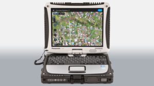
DRONELIFE first saw Pix4Dreact demonstrated in 2019. Designed with absolute practicality in mind, Pix4Dreact is made to work on the standard Toughbooks used by many public safety departments. Pix4Dreact has been field tested over and over since its release, providing real time data for disaster management – fast and reliable when it counts most.
Non-profits who would like to receive a free license can apply here – through a fast and simple form.
DRONELIFE met up with Christopher Cressy, Managing Director of Pix4D North America, on the show floor, and he talked about why Pix4D decided to implement the program.
Miriam McNabb is the Editor-in-Chief of DRONELIFE and CEO of JobForDrones, a professional drone services marketplace, and a fascinated observer of the emerging drone industry and the regulatory environment for drones. Miriam has penned over 3,000 articles focused on the commercial drone space and is an international speaker and recognized figure in the industry. Miriam has a degree from the University of Chicago and over 20 years of experience in high tech sales and marketing for new technologies.
For drone industry consulting or writing, Email Miriam.
TWITTER:@spaldingbarker
Subscribe to DroneLife here.
