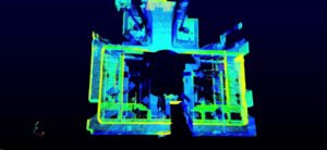
The DJI drone LiDAR program has been working towards making LiDAR more accessible – and today, they introduced Livox and Avia.
“DJI has been investing directly in lidar technology through its open innovation program that incubated Livox Technology Company,” says DJI. “Livox’s new 498 gram lightweight Avia lidar sensor is compact, capable and able to be attached directly to the DJI Matrice 200 and Matrice 300 series drones to enable highly accurate 3D aerial mapping. It features long-distance detection range up to 460 meters, high-density point clouds and supports up to three returns. By bringing this affordable and scalable lidar solution to the skies, use cases will extend well beyond the architecture, engineering, and construction (AEC) industry and open new ways for public safety professionals, utility inspectors, and more to digitize their operations with the power of drone and lidar technology.”
Christopher Chen, Livox Sales Director, says that part of Livox’ success comes from leveraging DJI’s production expertise: helping them to solve the problem of delivering less expensive and more accessible LiDAR technology. Avia was developed for integration into drones – but Chen says that Avia will also enable other robotics applications like autonomous vehicles.
Avia, first shown at CES at the beginning of this year, will be available for pre-order in September.
An integrated, lightweight LiDAR sensor could provide a major advantage for DJI in the enterprise market, where LiDAR solutions could revolutionize many of the mapping and inspection applications that drones provide.

Miriam McNabb is the Editor-in-Chief of DRONELIFE and CEO of JobForDrones, a professional drone services marketplace, and a fascinated observer of the emerging drone industry and the regulatory environment for drones. Miriam has penned over 3,000 articles focused on the commercial drone space and is an international speaker and recognized figure in the industry. Miriam has a degree from the University of Chicago and over 20 years of experience in high tech sales and marketing for new technologies.
For drone industry consulting or writing, Email Miriam.
TWITTER:@spaldingbarker
Subscribe to DroneLife here.
