The following is a Flyability press release.
January 8, 2020 – Flyability and Pix4D are pleased to announce the recent signature of a partnership agreement to offer bundled Flyability and Pix4D products. The bundle will be sold in the form of a Photogrammetry Add-On that can be purchased on top of Elios 2 drone packages. This offer is meant to facilitate access to a coherent and complete product offering to those who want to tackle indoor 3D modeling using photogrammetry.
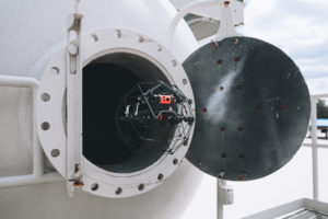
The design of the Elios 2 makes it a formidable tool to build 3D models of indoor spaces using photogrammetry. The photogrammetry processing engine of Pix4Dmapper is the industry-leading photogrammetry software solution. It delivers outstanding performances when it comes to processing non-georeferenced images ; a feature that is much needed when building 3D models of GPS-denied environments.
“Since the launch of Elios 2, we’ve seen a growing demand for a complete solution to deliver 3D models of confined spaces,” says Marc Gandillon, Marketing Manager with Flyability. “At first, it was not always obvious how building 3D models could bring value to our customers. Eight months after the launch of Elios 2, this is much more clear.”
To illustrate the value of 3D modeling in confined spaces, Flyability recently performed a demonstration for a customer who is running a refinery. The customer was wondering if they had to cut open the riser in one of their FCC units during a turnaround to remediate a defect. By looking at 2D pictures, it was challenging for them to determine the severity of the defect. By building a 3D model of the part of interest, they could immediately see that the defect did not threaten the functioning of the equipment, and remediation could wait for the next turnaround or proper planning. Using a 3D model literally saved them days of downtime.
“Drones and photogrammetry have proved their potential in many applications,” says Nikoleta Guetcheva, Head of Marketing at Pix4D, “but using the Elios 2 to create a 3D model now allows teams to make more informed decisions and provide a valuable record for the future in places that were once inaccessible to the human eye.”
The launch of the new Photogrammetry Add-On comes along with the launch of a new training course dedicated to Indoor Photogrammetry. This course will initially be available through Flyability directly and subsequently through its Authorized Training Centers, progressively throughout 2020.
Miriam McNabb is the Editor-in-Chief of DRONELIFE and CEO of JobForDrones, a professional drone services marketplace, and a fascinated observer of the emerging drone industry and the regulatory environment for drones. Miriam has penned over 3,000 articles focused on the commercial drone space and is an international speaker and recognized figure in the industry. Miriam has a degree from the University of Chicago and over 20 years of experience in high tech sales and marketing for new technologies.
For drone industry consulting or writing, Email Miriam.
TWITTER:@spaldingbarker
Subscribe to DroneLife here.
