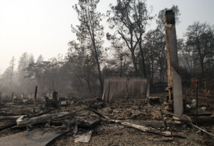
At today’s DroneDeploy 2019 conference, Greg Crutsinger of consulting firm Scholar Farms gave an inside look at drone mapping after one of California’s most devastating wildfires – the Camp Wildfires, which destroyed the town of Paradise, CA in 2019.
Crutsinger has a lot of experience in the drone industry, playing leading roles at major drone hardware and software providers since early in the industry’s growth. By now, he’s a known leader in the drone industry – and a resource for law enforcement and fire services in California. When the Camp Wildfires started – and it became clear that they would be devastating – Crutsinger was called in to help provide drone data to the emergency personnel and the communities affected.
As the fire died down, Crutsinger’s team of volunteers started to fly. “It required a lot of problem solving on the fly,” says Crutsinger. “Like capturing imagery that is being diluted by smoke.”
In addition to the smoke, regulators at first required the teams to maintain visual line of sight while staying under 200 feet in altitude. In the rolling hills of California, that meant very limited distances: and the team had to negotiate a rise to 300 feet in order to be effective.
The process of getting full overlap and high resolution maps is not just a question of flying, it’s a major administrative and technical undertaking: and it took a whole team of volunteers and multiple vendors to make it work for the Camp Wildfires. Law enforcement, Crutsinger’s team, DJI, providing human resources and hardware, and DroneDeploy working around the clock on processing were all part of the project… and Crutsinger says with humor that in the drone community, it’s important to make friends.
The team used the DroneDeploy platform to pre-plan missions, something that Crutsinger says was critical to success. “Ideally, agencies and cities would preplan their entire cities in advance of a disaster,” he says. Menlo Fire designed the missions in DroneDeploy, so that when pilots showed up they could be handed a pre-defined mission to perform.
Then came the challenge of managing the data. With local communications insufficient, the team decided to sneakernet the data to San Francisco, 3 hours away. DroneDeploy resources stayed up all night to batch upload the data and get the processing done.
“We mapped around 90% of the damaged areas within 2 days – dozens and dozens of zones,” says Crutsinger. “But then the work begins – putting the puzzle pieces together so that it can really be used.”
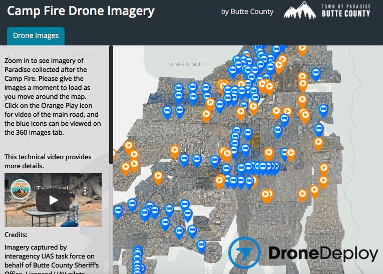
The DroneDeploy team was able to merge all of the orthos together and embed them in the county’s recovery website, where residents can click on their neighborhoods and get a detailed view. “The biggest impact was for the 30,000 people who had been evacuated and weren’t going to be able to return for another week ,” says Crutsinger. “They were able to see exactly what they’d be coming back to.”
In all, the team flew 500 flights, took 70k photos, and generated 477 GB of data – and they truned it around in 48 hours. It was a stunning achievement: a demonstration of what drones and the drone industry can do.
Miriam McNabb is the Editor-in-Chief of DRONELIFE and CEO of JobForDrones, a professional drone services marketplace, and a fascinated observer of the emerging drone industry and the regulatory environment for drones. Miriam has penned over 3,000 articles focused on the commercial drone space and is an international speaker and recognized figure in the industry. Miriam has a degree from the University of Chicago and over 20 years of experience in high tech sales and marketing for new technologies.
For drone industry consulting or writing, Email Miriam.
TWITTER:@spaldingbarker
Subscribe to DroneLife here.
