Whatever country you’re based in, it’s likely that there are regulations in place surrounding recreational and commercial drone flights. Some are fairly common-sense, such as the need to avoid airports, prisons and military bases. Others are less clear cut, like national parks or what constitutes a ‘public event’. Either way, the responsible thing to do is check whether it’s safe and legal to fly before your drone leaves the ground.
This is especially the case if you’re flying for commercial reasons. Not only is your insurance likely to be void in the event of flying in a no-fly zone, but your license could be revoked and your source of income stripped away. Better safe than sorry.
Luckily, wherever you live and work there’s a good chance that a simple application on your smartphone can give you all the information you need to make an informed decision. Here’s our rundown of the apps you need so that you can fly your drone within the rules.
Handy drone apps available worldwide
UAV Forecast
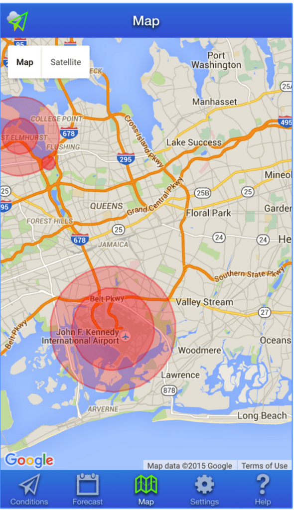
UAV Forecast is a great app that pilots, whether professional or recreational, should add to their arsenal. Few ‘Where Can I fly?’ apps offer this level of coverage. As well as giving you up to date forecasts regarding weather and wind speed, UAV Forecast shows you real-time flight restrictions and clearly identifies no-fly zones near your chosen location.

Price: Free
Available on: Andriod and iOS.
Hover
We’ve featured Hover several times in our ‘Top App‘ articles – and for good reason. The team at Hover has developed a drone app that’s easy to use and informative no matter what the purpose of your flight.
It’s also a lot more than just a map detailing no-fly zones. A few features of the Hover app include:
- International No-fly Zone Maps provided by AirMap.io
- An intuitive interface to help you navigate the skies safely
- Current weather conditions and forecasts, with a detailed breakdown of wind speed and direction, rain or shine, and temperature
- Flight Logs: Individuals and teams can seamlessly track, log, and maintain their drone fleet. Manage drones, equipment, and personnel
- Flight Readiness Indicator: An easy to understand flight status to let you know if it’s safe to fly your drone depending on the location and conditions
- News Feed, including coverage from DroneLife.com, helping pilots stay up to date with what’s going on in the drone industry
Price: Free
USA Only
B4UFLY
B4UFLY is the FAA’s own app designed to keep pilots and their drones operating within the law. Don’t expect any of the nice touches found in Hover of UAV Forecast – this is purely about keeping drone flyers up to date with legislation, helping them determine whether there are any restrictions or requirements in effect at the location where they want to fly.
Key features of the B4UFLY app include:
- A clear “status” indicator that immediately informs the operator about the current or planned location. For example, it shows flying in the Special Flight Rules Area around Washington, D.C. is prohibited.
- Information on the parameters that drive the status indicator
- A “Planner Mode” for future flights in different locations
- Informative, interactive maps with filtering options
- Links to other FAA UAS resources and regulatory information
Price: Free
Available: App Store for iOS and Google Play store for Android.
AirMap
AirMap is the provider of airspace maps to the FAA’s Know Before You Fly Campaign. The AirMap app was released to make drone operations safer by connecting UAV pilots to airport operators and air traffic controllers.
As of last year, AirMap had 75 airports onboard with the application, providing airport managers with a dashboard from which they can grant permission for drone flights and set specific automated policies for certain areas near their airports.
Arguably more for commercial than recreational use, AirMap gives pilots a clear view of nearby aerospace information and allows them to report when and where they’re going to fly. That information is given to airports so that accidents can be avoided.
AirMap offers these features and more:
– View Airspace Data
– Toggle Airspace Information & Advisory Map Overlays
– Super Fast Vector Maps
– Pilot Profile View
– Manage UAV Aircraft
– Create & Manage Flights (incl. Future Flights)
– File Digital Flight Notifications (D-NAS)
– View Public Flights
– RealtimeReal-time Alerts
– Toggle between Four Different Map Styles
– Search Map by Place or Location
Price: Free
Available on: Android and iOS.
UK Only
Drone Assist
Since the UK’s Civil Aviation Authority teamed up with the National Air Traffic Control Services to launch Drone Assist, UK drone pilots have downloaded the app in their thousands.
The CAA app gives users access to an interactive map of UK airspace, which is also used and updated by commercial air traffic. This gives pilots warning of areas to avoid or in which extreme caution should be exercised, as well as ground hazards that may pose safety, security or privacy risks when you’re out flying your drone.
It also contains a ‘Fly Now’ feature that enables you to share your drone flight location with other app users and the wider drone community, helping to reduce the risk of a drone-related incident in UK’ airspace.
Price: Free
Any ‘Where Can I Fly?’ apps that we’ve missed off our list? Let us know in the comments below.
Malek Murison is a freelance writer and editor with a passion for tech trends and innovation. He handles product reviews, major releases and keeps an eye on the enthusiast market for DroneLife.
Email Malek
Twitter:@malekmurison
Subscribe to DroneLife here.