As drone technology continues to bloom within the public-safety sector, firefighting agencies have especially found UAV tech beneficial in battling blazes.
In Horry County, S.C., the Fire-Rescue Department has applied for FAA approval to pilot its new DJI Phantom 3 in an effort to capture video footage of larger fires as well as aid in search-and-rescue and disaster evaluation efforts.
“We’ve submitted our application and we’re processing paperwork. It just takes time. Hopefully, by the beginning or middle of May we can put this in service,” Capt. Matthew Rice told Myrtle Beach Online, adding that the “potential return on a small investment like that is huge for us.”
The news report added that other South Carolina agencies are seeking FAA approval for firefighting, police and SAR uses including the Myrtle Beach Police Department and Murrells Inlet-Garden City Beach Fire Department. South Carolina Fire Association deputy director Jason Pope praised the growth of drone use. “Anything that gives a firefighter a better situational awareness is a good thing,” he said.
Drones played a huge role in fighting a fire at a Lincoln County, Mo. high school last week according to KTVI-TV. The county department shared drone video footage with local journalist Shawndrea Thomas demonstrating how officials used the quadcopter to ensure the safety of firefighters battling a blaze at a 9,000-square-foot field house at Troy Buchanan High School. Thomas reports that the Lincoln County Fire Department plans to spend another $8,000 to buy a thermal-imaging drone.
Advances in UAV technology are reaping major benefits for firefighting agencies around the world. The Korea Advanced Institute of Science and Technology recently unveiled Fireproof Aerial RObot System (FAROS) to the firefighting world.
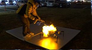
The drone system can not only detect fires in the tallest of skyscrapers, it can also search an engulfed building and transfer real-time data to human firefighters to build a better game plan for extinguishing a blaze. With the ability to roll over walls or fly, FAROS can deploy a 2-D laser scanner, altimeter and “Inertia Measurement Unit” sensor to navigate a building autonomously all while withstanding heats in excess of 1,832 degrees Fahrenheit.
In October, Massachusetts-based Olin College announced a partnership with MIT and drone company Scientific Systems to develop a vanguard of self-flying UAVS that can gather airborne, real-time data to send to crews fighting dangerous wildfires. Logistical data can help experts pinpoint how the fire is likely to spread and how best to deploy on-the-ground crews.
Jason is a longstanding contributor to DroneLife with an avid interest in all things tech. He focuses on anti-drone technologies and the public safety sector; police, fire, and search and rescue.
Beginning his career as a journalist in 1996, Jason has since written and edited thousands of engaging news articles, blog posts, press releases and online content.
Email Jason
TWITTER:@JasonPReagan
Subscribe to DroneLife here.