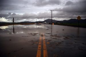
The “Phones and Drones” project aims to bring together drone images from citizens throughout the state to create a crowd-sourced map of the California coast, accurately recording the effects of El Niño to inform future conservancy efforts.
“Citizen scientists have the potential to capture far more images and at a more local scale than researchers could obtain on their own or through satellite data alone,” the Nature Conservancy statement explains.
“It’s incredible! You can take a picture and your phone automatically captures time, date, and a precise location. Geolocation features on phones are so good that you can map to within a meter or two of where you are,” says Sarah Newkirk, Senior Coastal Project Director for the Nature Conservancy in California. “We’ll be able to tell from time and date stamps on the pictures where they fall within the tidal cycle.”
DroneDeploy is a leading provider of cloud-based image processing software. They will allow all of the citizen scientists in the project to process their geotagged imagery for free, creating “high-resolution orthomosaic maps, digital surface models, and 3D models of California’s coast.”
The Nature Conservancy scientists will use the crowd-sourced data to adjust their climate models to get an accurate, statewide picture of how sea level rise, flooding and erosion are affecting the California coastline.
The data and analysis will result in a map of the coastline available to everyone to view.
“We are pushing the boundaries of modeling sea level rise and storms by combining information on sea level rise with river floods, and looking at how coastal habitats like wetlands will change. The models are good and the results of different models mostly agree with one another, but they would benefit from ground-truthing,” says Newkirk. “El Niño is a great opportunity to validate the models. It’s like looking through a crystal ball into a future of higher water levels and more frequent and severe storm events.”
Anyone with a phone and a drone can be part of this effort. To participate in the Phones and Drones project, read the full DroneDeploy brief here.

Miriam McNabb is the Editor-in-Chief of DRONELIFE and CEO of JobForDrones, a professional drone services marketplace, and a fascinated observer of the emerging drone industry and the regulatory environment for drones. Miriam has penned over 3,000 articles focused on the commercial drone space and is an international speaker and recognized figure in the industry. Miriam has a degree from the University of Chicago and over 20 years of experience in high tech sales and marketing for new technologies.
For drone industry consulting or writing, Email Miriam.
TWITTER:@spaldingbarker
Subscribe to DroneLife here.