by DRONELIFE Staff Writer Ian M. Crosby
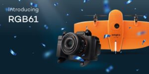
Leading VTOL drone producer Wingtra has revealed its new RGB61 sensor payload. Compatible with the WingtraOne GEN II drone, the RGB61 paves the way forward for the entire drone mapping industry. The Sony Alpha 7 Mark IV 61MP RGB camera has been customized to provide the most efficient, data-light UAV data solution available, with in-app light-settings control and ultra-high accuracy image capture.
“Because RGB61 allows you to capture 600 ha (1480 ac) in two flights, instead of three, and process 40 % less data for the same area, customers are going to be able to map large areas in tighter time windows, plus take on more projects due to dramatically faster turnaround times,” said Wingtra Product Manager Julian Mackern. “Imagine if you had a project that would take nine flight hours to cover before, and you could now do it in six but with roughly half the images to process. Because that is what you can do with this payload. All with richer image detail.”
RGB61 is an overall improvement from Wingtra’s prior flagship payload, the RX1R II, flying at 120 m (400 ft) with 60 percent overlap. RGB61 features a high-quality 24mm lens, optimizing data capture efficiency and preventing distortion. Enhanced image quality enables the identification of key features on maps and improves matching point identification in photogrammetry post-processing software. The payload is also highly integrated with WingtraOne’s mission-planning app, WingtraPilot, allowing for precise control within various light conditions.
“With this RGB61 integration, we offer customers a quick and intuitive way to make sure their images will be the best quality,” Mackern explained. “With the tap of a menu option in WingtraPilot, they choose the right camera settings for the light levels on the project site.”
The RGB61 provides optimal accuracy through integration with an advanced PPK GNSS data correction system. With RGB61, customers will maintain the ability to produce survey-grade results and sharp imagery from each WingtraOne GEN II VTOL fixed-wing drone flight, all with minimum ground control. Partnerships with leading companies such as Propeller and Pix4D also support the new level of resolution.
“Our customers work on sensitive projects like airports runway mapping and in projects where weather might constrict in flight windows. So capturing large areas, fast, is key to saving money, keeping personnel safe and delivering timely results to stakeholders,” said Wingtra VP Product Marcos Bayuelo. “From flight to deliverables, the RGB61 provides them with exactly this—without compromise on accuracy or image quality. We’re excited and confident that this payload will offer our customers better project times, clear ROI and a serious business advantage.”
Read more:
- Commercial UAV Expo’s Outdoor Flight Demos Highlighted the Latest Developments in the Field from Skydio, Autel, Wingtra and More
- Wingtra Gives Away Drones for a Good Cause: The Wingtra Earth Day Challenge
- 3D Drone Mapping Data Capture: WingtraOne GEN II’s Oblique Camera Configuration
- Pix4D and Wingtra: New Integration Makes Orthomosaic and Point Cloud Generation 2X Faster
Ian attended Dominican University of California, where he received a BA in English in 2019. With a lifelong passion for writing and storytelling and a keen interest in technology, he is now contributing to DroneLife as a staff writer.

Miriam McNabb is the Editor-in-Chief of DRONELIFE and CEO of JobForDrones, a professional drone services marketplace, and a fascinated observer of the emerging drone industry and the regulatory environment for drones. Miriam has penned over 3,000 articles focused on the commercial drone space and is an international speaker and recognized figure in the industry. Miriam has a degree from the University of Chicago and over 20 years of experience in high tech sales and marketing for new technologies.
For drone industry consulting or writing, Email Miriam.
TWITTER:@spaldingbarker
Subscribe to DroneLife here.