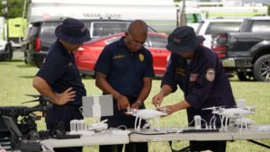
At today’s AUVSI XPONENTIAL Virtual Conference, the Airborne International Response Team (AIRT) and DRONERESPONDERS is making an announcement that could save lives all over the world. Emergency response remote pilots, their equipment, and public safety UAS programs will be listed together in a geo-referenced database to enable disaster management teams to find the resources they need.
The project is the brainchild of Brandon Karr, an expert in public safety drone applications from Pearland, TX. Karr started the project in 2020, recognizing the need to map public safety drone programs, industry, non-profits and federal programs that could provide mutual assistance in disaster response situations. Karr will work with DRONERESPONDERS as the project manager overseeing the initiative, which will now be a global effort.
“There is an incredible need for a comprehensive geo-referenced directory of public safety drone programs to help facilitate information sharing, training, and mutual assistance,” said Karr. “Working with AIRT, DRONERESPONDERS, and the Esri public safety team will help us increase the reach of this initiative around the globe.”
AIRT is working in partnership with Esri, the world’s leading location intelligence solution provider. The Esri system provides an ideal environment for identifying where trained emergency response remote pilots who could participate in management efforts, and public safety drone programs are located.
The AIRT project offers two separate tracks for UAS resources to be registered:
- Public safety agencies and emergency services organizations who are either developing, or have an active UAS program, can register via droneresponders.org
- Individual remote pilots who have the skills and capabilities to respond in complex emergencies should sign up at org
U.S-based public safety UAS teams and individual remote pilots who register under the AIRT/DRONERSPONDERS program will have the option of requesting inclusion in the Incident Resource Inventory System (IRIS), the inventory resource tool distributed by FEMA and used by emergency managers for identifying potential resources for incident response. IRIS submissions will be pre-qualified to assess whether they meet FEMA sUAS Resource Typing requirements for (1) Unmanned Aircraft Systems Team (2-508-1246) or (2) Technical Specialist – Unmanned Aircraft Systems (2-509-1382).
“DRONERESPONDERS will mark the home base and capabilities of the public safety UAS teams, and our AIRT GIS team will track the location of individual remote pilots with the proper experience and equipment to assist during emergencies,” said Christopher Todd, Executive Director, AIRT. “Within a few months, I expect we should have a database highlighting the World’s Largest Air Force® of geo-referenced, unmanned aviation assets for emergency response operations.”
“This project is really just the beginning of a longer process. First we need to build the database and map the resources,” said Todd. “From there, we will start to assess capabilities of the teams and their equipment. Eventually we will have a good sense as to where there are ‘response ready’ UAS assets available to assist with emergencies and disasters.”
The organization will soon deploy Esri ArcGIS Dashboards and geo-referenced StoryMaps that illustrate the quantity and location of registered emergency drone assets around the world. As the database develops, it will not only help disaster response teams to access resources, but will also help to demonstrate the growth and power of drones for emergency response.
“This initiative is a combined team effort to make positive impacts and ultimately save lives,” said Todd. “We invite other partners to join this project and help us illustrate the true potential of Drones For Good™ on a global scale.”
Miriam McNabb is the Editor-in-Chief of DRONELIFE and CEO of JobForDrones, a professional drone services marketplace, and a fascinated observer of the emerging drone industry and the regulatory environment for drones. Miriam has penned over 3,000 articles focused on the commercial drone space and is an international speaker and recognized figure in the industry. Miriam has a degree from the University of Chicago and over 20 years of experience in high tech sales and marketing for new technologies.
For drone industry consulting or writing, Email Miriam.
TWITTER:@spaldingbarker
Subscribe to DroneLife here.