The following is a guest post by Jaro Uljanovs, Lead AI Developer and Data Scientist at Sharper Shape, specialists in automated industrial inspections.
Artificial intelligence (AI) boasts a wide range of potential applications, across nearly every industry imaginable — healthcare, automotive, retail, even fast food. But it is the utility industry where AI and machine learning (ML) are beginning to demonstrate some of their most impactful effects on many aspects of the business. Power companies are increasingly leaning on AI to improve their electricity delivery an– in places like the Amazon and California – prevent potential wildfires through drone management software and vegetation management. In a post-COVID world where a reduced on-site workforce is quickly becoming the norm, AI is actually enhancing human jobs.
From data collection and analysis to the presentation of actionable insights, AI and ML algorithms are quickly redefining how utility companies manage their electric infrastructure.
Consolidating and classifying data
Utility companies oversee massive infrastructure networks, comprising poles, conductors, substations. Transmission and distribution lines which contain these crucial components, span thousands of miles. Vegetation management around this key infrastructure must also be monitored, as it presents a danger of fire or outage.
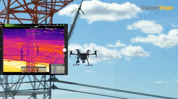
Taking a comprehensive snapshot of these assets means utilizing a variety of different sensors for powerline inspections. These sensors include light detection and ranging (LiDAR), color (RGB), hyperspectral and thermal imagery.
This allows the drone mapping software to capture everything — from vegetation proximity, to infrastructure assets, to individual components (such as insulators on transformers) and their operational integrity, to hot spots indicating potential fire risks.
That is a lot of data to capture, catalog and process. And there are a lot of individual elements within that data — even in just one image — to pinpoint and classify, let alone do so accurately. Classifying billions of data points across all those sensors is an impossibly time-consuming task to do manually.
AI and ML tools can accomplish that same work — scanning thousands of images collected across thousands of miles of utility infrastructure — in seconds. LiDAR point cloud segmentation can detect conductors (quite a difficult component-type to segment) with an accuracy of over 95% for each individual point, while hyperspectral image segmentation can identify vegetation species with an accuracy of up to 99%.
More than that, when paired with drone sensors, these algorithms can also improve the upfront data collection. AI and ML tools help to adjust the sensor systems positioning in real time. In the event a signal is lost or the drone veers slightly away from its inspection flight path, an EDGE AI algorithm running on the professional drone or pilot hardware, can help the drone to readjust its focus through object detection, or avoid collision through on-board collision avoidance
By helping to readjust the sensors’ bearings while in flight, AI not only ensures more accurate data collection, but guarantees that the flight doesn’t need to be repeated or prematurely ended because of inaccurate data collection, saving valuable time and resources. ML techniques can spot any faults in the sensors or the drone’s flight path while in the air, recalibrating as needed and identifying individual elements within the data as it comes through the sensor’s video feed.
Breaking down silos to create a holistic data approach
Key to all of this is eliminating the silos that tend to naturally build up between different data segments. In the utility inspection space, asset management, and vegetation management, different sensors and so on all produce their own disparate, walled-off sets of data.
When data is kept siloed like this, it becomes unnecessarily difficult, for teams to derive company-wide insights or conclusions from the information being collected. And what good is all that data if it can’t be used to check against itself and compliment other sets of data?
Good data management cannot exist in a piecemeal approach. It needs to be holistic, and AI provides the impetus to make that happen. AI provides a central resource for pooling all these data sources together, making it easier for data analysis for potential problems — like wildfire-prone vegetation or damaged components. When these issues are collected in one system, it becomes much easier to identify faults and resolve them — and do so far faster than it would be to manually sift through countless images of poles or vegetation maps.
In spite of all the common concerns about AI eliminating work for human beings, at utility companies AI actually enhances the role that people have to play in the network and powerline inspection process. Because the AI is the tool that carries out the data analysis, it is not something that is dependent on the potentially biased expertise of a professional human inspector, nor is it prone to fatigue and the anomalous results that can come from that, rather the drone inspection software. But at the same time, AI cannot do everything itself. It is a method for presenting clearer, more accurate and more actionable information for people to then act on with their own judgment.
There are a lot of easy-to-make assumptions, both good and bad, about AI. With communities beginning to emerge from lockdown and social distancing heralding a marked shift in day to day life, what AI really means for the utility industry is less reliance on manual inspections and a more efficient and effective tool for providing the right information about a power company’s infrastructure — its transmission and distributions lines, its poles, and its nearby vegetation — into the hands of its key decision makers.
Miriam McNabb is the Editor-in-Chief of DRONELIFE and CEO of JobForDrones, a professional drone services marketplace, and a fascinated observer of the emerging drone industry and the regulatory environment for drones. Miriam has penned over 3,000 articles focused on the commercial drone space and is an international speaker and recognized figure in the industry. Miriam has a degree from the University of Chicago and over 20 years of experience in high tech sales and marketing for new technologies.
For drone industry consulting or writing, Email Miriam.
TWITTER:@spaldingbarker
Subscribe to DroneLife here.
