


Drones in the NCDOT
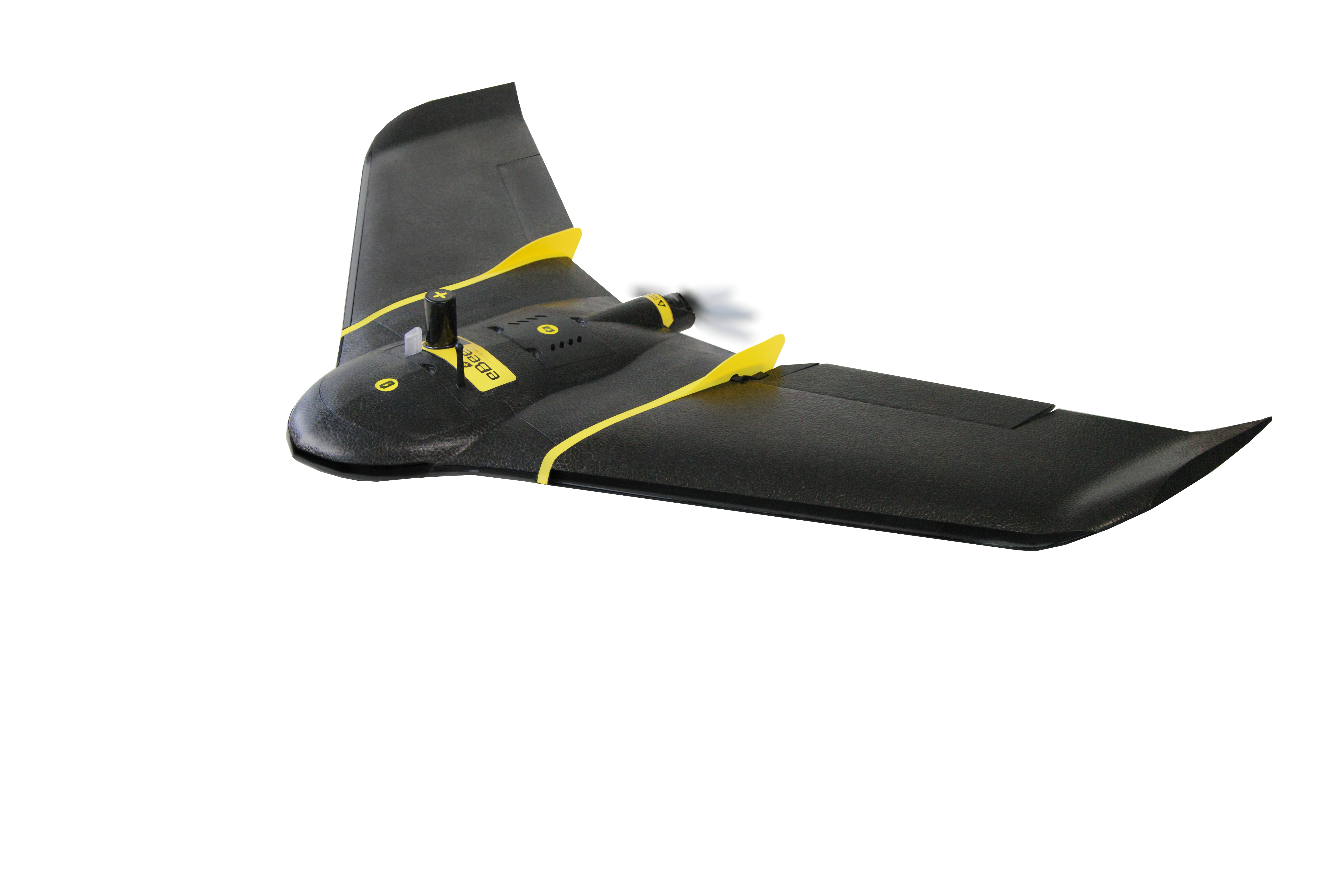
North Carolina has 80,000 road miles, 72 publicly owned airports, more than 300 private airports, and an extremely varied landscape. Drones are heavily integrated into state operations, with more than 31 aircraft across the state performing missions on everything from wildflower documentation to disaster response. Primarily, the DOT used quadcopters: but, as Divakaran points out, they aren’t always appropriate.
“Fixed wings aren’t used a lot,” says Divakaran. “That’s due to a lack of education. People think that a fixed wing needs so much more space to take off and land, but the flight length is also much longer.”
Integrating Drones into Disaster Response
That increased flight endurance is why Divakaran is integrating fixed wing drones into disaster response efforts in the state. The state’s terrain includes mountains – where landslides are a relatively common event. Traditionally environmental teams wearing full protective gear and use safety ropes to perform an inspection. Quadcopters don’t necessarily have the endurance to map an entire mountain -but a fixed wing can get the necessary images to document road damage for the entire area, resulting in fewer dangerous manual inspections.
On the other side of the state, says Divakaran, there are coastal roads that become flooded with every storm. Previously, using a quadcopter, Divakaran’s team might have to fly for 10 hours: mapping the roads 10 minutes at a time to land and swap out batteries. It’s a grueling and frustrating mission to cover a relatively short distance. “This is where corridor mapping really could have helped us,” Divakaran says. “There were no people [to fly over.] If we could have done the whole 16 miles with one flight, it would have saved us a lot of time.”
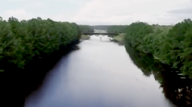
“We were very fortunate there were no lives lost,” says Divakaran. The footage is impressive and almost hauntingly beautiful, showing roads washed out and waterways flooded: and the long range helped document stretches of damaged road infrastructure.
Divakaran says that post hurricane, the drone operations were a success. “We were able to communicate conditions to get people off of the road, to monitor evacuation routes and traffic, and get real time information on infrastructure.”
NCDOT’s video of Interstate 40 flooding.


Miriam McNabb is the Editor-in-Chief of DRONELIFE and CEO of JobForDrones, a professional drone services marketplace, and a fascinated observer of the emerging drone industry and the regulatory environment for drones. Miriam has penned over 3,000 articles focused on the commercial drone space and is an international speaker and recognized figure in the industry. Miriam has a degree from the University of Chicago and over 20 years of experience in high tech sales and marketing for new technologies.
For drone industry consulting or writing, Email Miriam.
TWITTER:@spaldingbarker
Subscribe to DroneLife here.