It’s undeniable that drones are an amazing way to enjoy some of the most stunning scenery that the U.S. has to offer. Wilderness areas, however, are designed to protect wildlife – and unfortunately, any motorized equipment – including drones – can disrupt or disturb protected animal populations.
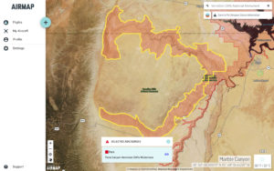
That’s why Tread Lightly!, a national educational non-profit, has partnered with leading airspace intelligence platform AirMap and the U.S. Forest Service (USFS) to help educate drone users areas to avoid – and the designated fly zones where they can fly without harm to the environment.
The following is a Tread Lightly! press release.
CENTERVILLE, Utah (July 30, 2019) – Working jointly with the United States Forest Service (USFS) and AirMap, the leading global airspace intelligence platform for drones, the national nonprofit Tread Lightly! has released a new print public service announcements (PSAs) and launched a campaign to educate drone users about designated fly zones over public lands.
The new PSA reminds users that drones are classified as a form of “motorized equipment” by the USFS and therefore prohibited in designated Wilderness Areas. The PSA also encourages safety and use of drones only in
“The Forest Service wilderness program wanted to develop these educational pieces to address the growing popularity of using drones on public land,” said Sandra Skrien, National Wilderness Program Manager of the U.S. Forest Service. “As the drone community grows, we want to take a leadership role in addressing important recreation issues to help minimize impact and protect wildlife.”
Along with the PSA, Tread Lightly! has partnered with AirMap to help drone operators find designated fly zones as well as areas where drone use is restricted. With more than 250,000 registered users worldwide, AirMap’s easy-to-use fly mobile and web applications help drone operators plan and conduct drone flights in compliance with regulations. Drone operators can download the AirMap app today to access information on designated fly zones over public lands.
“We are excited to partner with Tread Lightly! and address the safe and regulated use of drones over public lands through the AirMap for Drones application,” said Steve Willer, AirMap’s Manager for Territory Sales, Americas. “By informing drone operators about designated fly zones, we can help minimize impacts on wilderness and public lands.”
This PSA is the most recent addition to a full campaign of drone-related messaging first developed by Tread Lightly! and the USFS in 2017. PSAs and other educational materials addressing drones-related recreation issues can be found at treadlightly.org. Tread Lightly! hopes those in the drone community will embrace and share this message to help encourage proper use.
“Tread Lightly! is a positive resource for all public land users and managers,” said Keith Gordon, Tread Lightly!’s Executive Director. “We are striving to be at the forefront of emerging recreation issues so that users are aware and to stop impacts before they can even start. Thanks to support from groups like AirMap and the Forest Service, we can reach a broader audience and protect access to public land at the same time.”
Miriam McNabb is the Editor-in-Chief of DRONELIFE and CEO of JobForDrones, a professional drone services marketplace, and a fascinated observer of the emerging drone industry and the regulatory environment for drones. Miriam has penned over 3,000 articles focused on the commercial drone space and is an international speaker and recognized figure in the industry. Miriam has a degree from the University of Chicago and over 20 years of experience in high tech sales and marketing for new technologies.
For drone industry consulting or writing, Email Miriam.
TWITTER:@spaldingbarker
Subscribe to DroneLife here.
