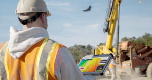
The platform provides custom analytic models for industries such as mining, construction, and agriculture to “enable more accuracy and precision to deliver bottom-line benefits.”
Delair CEO Michael de Lagarde states:
“It has become clear that data and software are the real end game in effective commercial drone use by enterprises. These businesses demand not just innovative technology but enterprise-ready solutions that offer the scalability, reliability, and security they need, as well as the ability to integrate with other key business processes. With Delair Aerial Intelligence we can offer the combined power of an enterprise-focused workflow and proven industry-specific analytics to help turn aerial data into actionable business insight.”
Features include:
Productivity-oriented visualization tools
Intuitive commands allow the user to visualize a site in 2D or 3D. Tools include support for orthophotography, slope maps, digital surface models and 3D models. Measurement is made simpler with integrated toolsets for calculating length, determining an area size or calculating stockpile volumes.
Real-time collaboration
Real-time collaboration is available through annotation features, integrated conversation threads and instant notifications from team members, allowing drone data to be overlaid with other geospatial data. The feature supports popular commercial formats and creates data to be easily exported to a range of industry-standard software suites and reporting formats.
Industry-optimized analytics
Company officials say the platform supports “the largest suite of analytics packages for specific applications in different industries.” For the mining industry, this means efficient methods to control and report inventory, or monitor site safety as two examples. Construction clients can oversee job progress and “dig into” the logistics of earth-moving jobs.
Last month, the company released new integration features to its Trimble Business Center software. The integration enables geospatial professionals to drag and drop data from the Delair UX11 PPK drone system directly into Trimble Business Center projects.
In November, Delair introduced a new drone model focused on the agriculture industry — the UX11-Ag. Built on the UX11 fixed-wing drone footprint, the new version combines the productivity benefits of long-range/BVLOS flight operations with highly accurate survey-grade mapping and plant data collection capabilities.
Jason is a longstanding contributor to DroneLife with an avid interest in all things tech. He focuses on anti-drone technologies and the public safety sector; police, fire, and search and rescue.
Beginning his career as a journalist in 1996, Jason has since written and edited thousands of engaging news articles, blog posts, press releases and online content.
Email Jason
TWITTER:@JasonPReagan
Subscribe to DroneLife here.