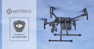
A leading supplier of drone-based remote sensing, analytics, and IoT solutions to the agriculture industry is reaping a new crop of sensor technology. Last week, Sentera announced the launch of the AGX710, a gimbaled precision agriculture sensor with plug-and-play integration for DJI’s Matrice 200 Series quadcopters.
“The AGX710 sensor delivers exceptional crop health insights and enables ag professionals to develop high-precision spectral index measurements and run deep learning algorithms on acquired data,” a company press release states.
The sensor array dumps data into Sentera’s FieldAgent Platform that can then detect crop disease and pests, identify deficiencies and determine overall nutrition status. The platform offers a mobile app for flight planning. Communicating with DJI’s transmission system, the solution delivers live-streaming video. Comprehensive gimbal and camera control is available directly from the drone’s remote controller.
“We are excited to deliver such an elegant, high-accuracy product to the market,” Sentera CEO Eric Taipale said. “Our customers love DJI drones, and DJI’s new payload developer tools allow us to make it unbelievably easy to add Sentera sensing to an M200 Series platform, and incredibly simple for our customers to gather actionable data from the field.”
We are proud to have the Sentera team bring their innovative agriculture sensor to our Matrice 200 Series drones,” said Jan Gasparic, Head of Enterprise Partnerships at DJI. “Working together with payload developers like Sentera makes it easier than ever to use DJI drones for specialized applications in the commercial drone industry, giving customers in agriculture, energy, and public safety more access to the tools they need to get the job done.”
In 2017, Sentera announced its gimbaled Double 4K and Quad sensors for the DJI Inspire 2 drone. Paired with the Inspire 2, the package offers agronomists, crop consultants, and growers an economical way to capture diverse vegetation indices such as normalized difference vegetation index (NDVI) or normalized difference red edge (NDRE) data while investing in a single drone platform.
Jason is a longstanding contributor to DroneLife with an avid interest in all things tech. He focuses on anti-drone technologies and the public safety sector; police, fire, and search and rescue.
Beginning his career as a journalist in 1996, Jason has since written and edited thousands of engaging news articles, blog posts, press releases and online content.
Email Jason
TWITTER:@JasonPReagan
Subscribe to DroneLife here.