By Mike Winn, CEO and co-founder, DroneDeploy —
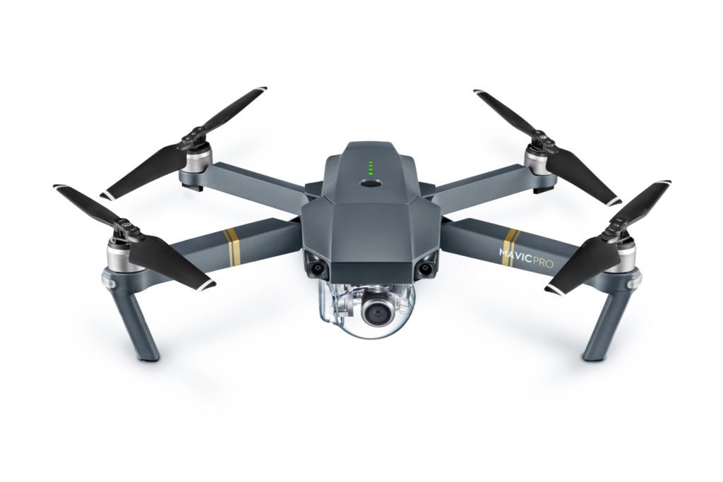
The DJI Phantom was the world’s most popular commercial drone, according to Section 333 filings. Now, the Mavic is set to dethrone it.
It may come as a surprise to some that the Phantom was so popular, after all the marketing of “Commercial” drones being larger, more expensive and supposedly made of premium materials. It turns out that doesn’t matter to most use cases. The bottom line is that the most popular commercial drones need to be easy to use, reliable and produce great imagery. After all, it’s the data that matters, not the tool. The Mavic has all of that in spades.
Even considering DJI’s recent announcement of the new Phantom 4 Pro with it’s impressive 20Megapixel camera, 1-inch sensor, and all-sided sense and avoid, I’d still go so far as to say the Mavic is going to be an historically important device — perhaps the most important drone launch since the Phantom Vision 2+. It represents a fundamental step up in usability, for consumers and commercial operations alike. Here’s why.
Truly Portable
They say the best camera is the one you have with you. This is true of drones, too. The Mavic is the first truly portable commercially-capable drone. It’s carriable in almost any bag, with the device and the remote both being a faction of the size and half the weight of a Phantom. Until now, you needed a dedicated bag just to carry a drone. Not so with the Mavic. It can fit in almost any existing bag – even most handbags as DJI was only too eager to show on launch day.
Safety
The Mavic is the least risky commercial drone ever. Weighing in at just 734g (47% less than a P4), the Mavic has half the kinetic energy to dissipate in the event of a crash. A user on mavicpilots.com calculates that the Mavic’s kinetic energy is less than a golf ball. Further, the blades are hinged, so as well as being lighter than the larger Phantom blades, they will bend and are less likely to cause serious harm on impact.
Sitting alongside a DSLR – myfirstdrone.com
Simplicity
The Mavic is the easiest-to-fly DJI drone yet. One feature that’s particularly interesting in is the new Precision Landing system. A Phantom 4 will land within 3-6ft of take off, a margin of error that’s wide enough for a drone to land on a curb or hit an object, frequently prompting drone pilots to land manually even when otherwise automating flight using software like DroneDeploy. Precision Landing means there’s one less thing to worry about in operation and is a prerequisite for landing on charging pads in the future.
Better Streaming
The Mavic supports a new version of DJI’s lightbridge, called Ocusync, with range of up to 7km. It’s not the range specifically that’s important (not many use cases require that range), but rather the additional strength will enable more reliable operations in radio-noisy environments. Additionally, the ability to stream back 1080P will enable inspectors to better identify cracks and other details in real time. While the new Phantom 4 Pro and Inspire 2 will also both have improved streaming, the Mavic remains unique for connectivity strength within its size category.
Inexpensive
Starting at just $750 (without remote), the Mavic is an easy purchase for any commercial enterprise. About half the price of a P4, you’ll be seeing this as the first drone for many agronomists, construction foremen, and insurance inspectors alike.
It’s not without any downsides. The Mavic has a tighter field of view, which on the one hand means that you can you can fly relatively further from an object and get the same imagery — great for inspection — but also limits how much ground you can cover when mapping on a single battery.
Of course we’ll be seeing future drones launch with many of these features (and more) but this will be the first, with a price point and size that’s virtually unbeatable (for now).
P.S. DroneDeploy now fully supports the Mavic for both automated mapping flight and map processing. You’ll just need to update your Mavic to the latest firmware to get geotagged imagery. We’ve noted an issue with exposure, but I’m sure this will be fixed in short order.
Mike Winn is the CEO of DroneDeploy, a powerful, cloud-based image processing software that is compatible with any drone. You can learn more about DroneDeploy here and start making aerial maps and 3D models for free by signing up here.
Miriam McNabb is the Editor-in-Chief of DRONELIFE and CEO of JobForDrones, a professional drone services marketplace, and a fascinated observer of the emerging drone industry and the regulatory environment for drones. Miriam has penned over 3,000 articles focused on the commercial drone space and is an international speaker and recognized figure in the industry. Miriam has a degree from the University of Chicago and over 20 years of experience in high tech sales and marketing for new technologies.
For drone industry consulting or writing, Email Miriam.
TWITTER:@spaldingbarker
Subscribe to DroneLife here.
