Guest post by Kay Wackwitz, Drone Industry Insights —

It should be mentioned that compared to other options, UAVs are rather limited in terms of the amount of payload they can carry. This is why light, non-professional consumer cameras are generally used, although they cannot match the quality of stable metric cameras. Yet, even with those comparatively inexpensive cameras, it is possible to attain results that are more than sufficient for the needs of the construction industry.
– Prof. Thomas P. Kersten, HafenCity University Hamburg, Geomatics Lab
Now, what does this mean for you business?
The possibility to shorten the surveying process through the support of UAV solutions contains the potential to enormously reduce the time and monetary investment – for every project, for every surveying company and in every country. Surveyors can not only increase their productivity by being able to carry out more projects in the same amount of time, but they can also work with a more qualitative dataset, which makes it possible to conduct better, more thorough planning.
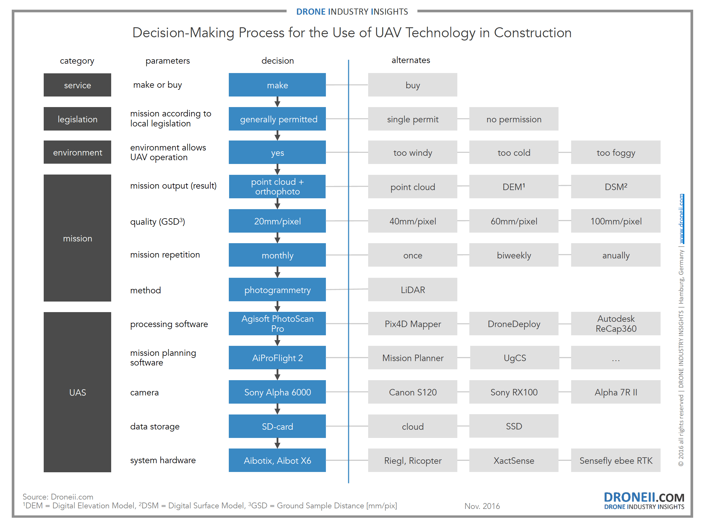
To make the right decisions it is important to define the results you need. Therefore you can use the inverse decision-making process below. After the initial question if you want to hire a professional drone operator or starting a drone operation yourself it necessary to have a close look at the local regulations and environmental conditions. Once the mission and all aspects of operation are clear, you can start to configure the unmanned aerial system (UAS). With all information describing your plans (incl. fixed and operational costs) you can now chose again whether to start your own drone operation or to buy in the service.
Click on the image for more info

Looking at the entire value chain it becomes clear that many resource- and time-intensive activities can be replaced. Looking at repetitive activities (e.g. checking construction progress of the same location), the savings through UAV operation can be even greater.
The report “Value Chain Analysis for UAV-based Surveying” represents the essence of what you need to know if you consider using drone technology. It offers a detailed outline of technological, legal and operational aspects of UAV application in comparison to conventional surveying methods. The question when UAV technology in the construction industry pays off economically is discussed in detail.
In addition to the Drone Business Development Guide 2016 which outlines the basics of a UAV market entry, this report is mission specific and provides the most comprehensive analysis about commercial UAVs in action so far. This report was created with the support of construction surveying and UAV experts.
In case you have missed one of our previous articles:
Frank Schroth is editor in chief of DroneLife, the authoritative source for news and analysis on the drone industry: it’s people, products, trends, and events.
Email Frank
TWITTER:@fschroth