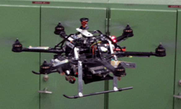
If drones are to ever become main-stream, advanced innovation in semi-autonomous and autonomous models must continue to expand. In fact, researchers with the Swiss Federal Institute of Technology are developing drones that may someday take the driver’s seat in commercial applications.
The team has developed a prototype AscTec Firefly that can, according to the MIT Technology Review, “build its own 3-D map of an unfamiliar environment with minimal help from a human operator, and then plan its own routes around a space and its obstacles autonomously.”
“This is the first time we can show full mapping, relocalization—finding the drone on the map—and planning on board,” researcher Michael Burri tells MIT.
The Swiss model weighs just over 3.5 pounds and is equipped with a high-def camera and sensor array that can self-report the drone’s orientation, velocity and other data that will then allow software to render a 3D map by comparing video footage with the data.
The project is similar to a Japanese effort to develop an autonomous drone the difference being that the project in Japan uses laser guidance to avoid obstacles as it surveys the interior of buildings at Tokyo Electric Power Co.’s Fukushima No. 1 plant.
Like the Japanese model, the Swiss research team successfully tested the drone in an industrial setting, turning the drone loose at a former industrial site replete with tricky duct work, pipes and equipment. The Japanese drone completed a test flight at the nuclear plant’s No. 5 reactor building, which escaped severe damage in the March 2011 nuclear disaster.
Autonomy in drone flight is a growing topic of research across the world. At Mexico’s National Institute of Astrophysics, Optics and Electronics (INAOE), José Martínez Carranza is breeding a cutting-edge UAV autonomy system that will allow drones to “learn” to navigate without a GPS signal or pilot backup. According to Science Daily, Martinez’s system will “estimate the position and orientation of the vehicle, allowing it to recognize its environment, hence to replace the GPS location system for low-cost sensors such as accelerometers, gyroscopes and camcorders.” Known as the oddly named RAFAGA (Robust Autonomous Flight of unmanned aerial vehicles in GPS-denied outdoor areas), the system will use the drone’s video camera and apply an algorithm to help the UAV orient and navigate via a map-drawing function that judges the drone’s position relative to its destination.
MIT Reports that the Swiss team will continue to work on improvements to its autonomous model, including the “ability to avoid collisions with moving objects that don’t appear on its map—for example humans or moving equipment.”
Jason is a longstanding contributor to DroneLife with an avid interest in all things tech. He focuses on anti-drone technologies and the public safety sector; police, fire, and search and rescue.
Beginning his career as a journalist in 1996, Jason has since written and edited thousands of engaging news articles, blog posts, press releases and online content.
Email Jason
TWITTER:@JasonPReagan
Subscribe to DroneLife here.
