(Source: technologyreview.com)

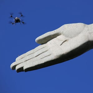
The project was intended to help efforts to preserve the statue and to demonstrate how drones could lead to a dramatic increase in high-resolution 3-D replicas of buildings, terrain, and other objects. Being able to easily and frequently capture detailed 3-D imagery could have many uses, such as speeding up construction projects and helping Hollywood make better special effects, says Christoph Strecha, CEO and cofounder of Pix4D, the Swiss company that led the project. It collaborated with drone manufacturer Aeryon Labs and researchers at PUC University of Rio de Janeiro.
Mapping tools from companies including Google and Apple have made outdoor 3-D imagery commonplace in recent years. But they are mostly built with 3-D data from aircraft carrying expensive equipment. The 3-D shape of buildings and terrain is most often captured using a technique called lidar, which uses lasers. The photo-real 3-D models of cities in Apple’s “flyover” mode are made by processing images captured by a complex and expensive array of cameras (see “Ultrasharp 3-D Maps”). Both techniques rely on very accurate GPS technology.+
Continue Reading at technologyreview.com…
Alan is serial entrepreneur, active angel investor, and a drone enthusiast. He co-founded DRONELIFE.com to address the emerging commercial market for drones and drone technology. Prior to DRONELIFE.com, Alan co-founded Where.com, ThinkingScreen Media, and Nurse.com. Recently, Alan has co-founded Crowditz.com, a leader in Equity Crowdfunding Data, Analytics, and Insights. Alan can be reached at alan(at)dronelife.com
