Just as UAV technology has spawned a new wave of innovative engineering, several recent initiatives are starting to harness the impending data-boom that will emanate from our increasingly crowded skies.
Because there is no RMV for drones (yet), several privately owned websites are looking to get into the game early by creating communities and information hubs to crowdsource the collection of relevant data from all over the world:
Dronestagram: While some advocates like Drone Shield worry about privacy, other proponents envision a world where drones create even wider maps from the skies. Drawing on the popularity of social media giant Instagram, French website Dronestagram is a network for drone pilots to share information and images to “build a world map of our Earth with a bird’s eye view.”
Users post their best aerial photos and Dronestagram curates and tags the images based on categories such as “urban, country, industrial, pro, amateur, sports.” Images and videos also depict drone crashes – under the subheading “Crazy Stuff.”
In the summer, Dronestagram holds a competition where the community votes on the best pictures posted that year. You can check out the breathtaking photos that won the 2014 competition right here!
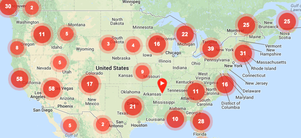
Travel By Drone.com: Upon logging into Travel By Drone, a map immediately pops up depicting Europe covered in red dots. No, the Continent isn’t suffering from measles. The dots simply represent geographic locations where drones have captured footage (think of Google Streetview from the sky).
Users can share drone-recorded videos from YouTube and geo-tag the location – hence the map. Most of the videos (556) center around Germany and northern Italy but U.S. locations are slowly popping up as well.
Humanitarian UAV Map: Dr. Patrick Meier (@PatrickMeier) looked at the Travel by Drone model and noticed the concept could potentially direct post-crisis relief and rescue by crowdsourcing the same geo-tagged drone footage. Writing at iRevolution, Meier says the self-dubbed “Humanitarian UAV Map’” (HUM) project will be linked to the Humanitarian UAV Network, a “global volunteer network of professional, civilian and responsible hobbyist UAV pilots who facilitate information sharing, coordination and operational safety in support of a broad range of humanitarian efforts.”
Mapbox: With all the crowdsourcing and drone watching, it’s always a good idea to make sure any given drone flight is legal -or, at the very least, not illegal. Mapbox has developed a special map that “represents areas where it is not recommended to fly drones due to regulations.”
Airports, National Parks and military bases are all marked and outlined so you know exactly where you should not fly your drone.
Drones Made Easy: Backed by Chris Andersen and Helen Greiner (of 3D Robotics and CyPhy Works, respectively) Drones Made Easy is an attempt to make aerial, 3D mapping affordable and accessible. The service “allows users to easily upload raw aerial imagery for processing into high quality stitched aerial imagery or into geo-referenced maps suitable for use in GIS applications.”
You can contribute to the Drones Made Easy Kickstarter campaign here and watch the video below!
Jason is a longstanding contributor to DroneLife with an avid interest in all things tech. He focuses on anti-drone technologies and the public safety sector; police, fire, and search and rescue.
Beginning his career as a journalist in 1996, Jason has since written and edited thousands of engaging news articles, blog posts, press releases and online content.
Email Jason
TWITTER:@JasonPReagan
Subscribe to DroneLife here.
