AirMap whose goal is to make “drones part of everyday life by building the airspace services platform to let innovation take flight.” has announced that fifty airports are preparing to provide LAANC authorization this fall.
Here is the announcement:
Cincinnati/Northern Kentucky International, Miami International, Phoenix Sky Harbor International, San Jose International, and Reno-Tahoe International, among others, are expected to offer automated authorization in controlled airspace before the end of the year, with the rest of the nation’s airports to follow in 2018.
Today, flights in controlled airspace, at certain times of day, or near sensitive locations require authorization from the FAA. Authorization requests are subject to long waiting periods of up to 90 days and labor-intensive manual approvals, which can delay or even prevent commercial operations from getting off the ground.
To address these challenges, the FAA has convened a small group of 12 companies, including AirMap, to determine how third party vendors can help the FAA provide automated authorization for safer and more efficient drone operations at scale.
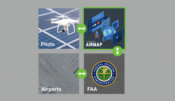
This Low Altitude Authorization and Notification Capability, or LAANC, will allow drone operators to apply for instant, digital approval to fly in U.S. controlled airspace using the same applications they use for flight planning and in-flight situational awareness.
LAANC began earlier this summer with the FAA’s release of UAS facility maps depicting specific areas and altitudes near more than 300 airports where drone operators can request airspace authorization more effectively and efficiently. Within 24 hours, these facility maps were available to commercial drone operators on the AirMap platform.
And now, 50 of the nation’s airports have been chosen to begin providing LAANC authorization by the end of the year, giving us a sneak peek at how Unmanned Traffic Management (UTM) will work in the U.S. – and how AirMap is making UTM possible for the commercial drone industry at scale.
The complete list of the first 50 airports can be found below. Learn more about what LAANC means for the commercial drone industry in AirMap cofounder Greg McNeal’s recent article in Forbes.
| Class | Code | Airport |
| B | CVG | Cincinnati/Northern Kentucky International Airport |
| B | MIA | Miami International Airport |
| B | PHX | Phoenix Sky Harbor International Airport |
| C | ANC | Anchorage International Airport |
| C | GRB | Green Bay- Austin Straubel Int’l Airport |
| C | LNK | Lincoln Airport |
| C | RNO | Reno- Tahoe International Airport |
| C | SJC | San Jose International Airport |
| D | LHD | Lake Hood Seaplane Base |
| D | MRI | Merrill Field |
| E | ABR | Aberdeen Regional Airport |
| E | AMW | Ames Municipal Airport |
| E | ATY | Watertown Regional Airport |
| E | AXN | Alexandria Municipal Airport |
| E | BJI | Bemìdji Regional Airport |
| E | BKX | Brookings Regional Airport |
| E | BRD | Brainerd Lakes Regional Airport |
| E | CIU | Chippewa County International Airport |
| E | CMX | Houghton County Memorial Airport |
| E | DIK | Dickinson Airport |
| E | DVL | Devils Lake Regional Airport |
| E | EAR | Kearney Regional Airport |
| E | ELO | Ely Municipal Airport |
| E | ESC | Delta County Airport |
| E | FFM | Fergus Falls Municipal Airport |
| E | FOD | Fort Dodge Regional Airport |
| E | FRM | Fairmont Municipal Airport |
| E | HIB | Range Regional Airport |
| E | HON | Huron Regional Airport |
| E | HSI | Hastings Municipal Airport |
| E | IKV | Ankeny Regional Airport |
| E | IMT | Ford Airport |
| E | INL | Falls International Airport |
| E | IWD | Gogebic- Iron County Airport |
| E | JMS | Jamestown Regional Airport |
| E | MCW | Mason City Municipal Airport |
| E | MHE | Mitchell Municipal Airport |
| E | MKT | Mankato Regional Airport |
| E | OFK | Norfolk Regional Airport |
| E | OLU | Columbus Airport |
| E | OSC | Wurtsmith Air Force Base |
| E | OTG | Worthington Municipal Airport |
| E | PIR | Pierre Regional Airport |
| E | PLN | Pellston Regional Airport |
| E | RHI | Rhinelander- Oneida County Airport |
| E | RWF | Redwood Falls Municipal |
| E | SLB | Storm Lake Airport |
| E | SPW | Spencer Municipal Airport |
| E | TVF | Thief River Falls Regional Airport |
| E | YKN | Chan Gurney Airport |
Frank Schroth is editor in chief of DroneLife, the authoritative source for news and analysis on the drone industry: it’s people, products, trends, and events.
Email Frank
TWITTER:@fschroth